 Läpäise tentti helposti Premium Practice Testit | Avaa kaikki 7 päivää Plan
  Tarjous päättyy vuonna

Informatiiviset kyltit
- 1/40
This directional sign shows the names of towns (Lahti, Lammi, Turenki) along with distances or route numbers, guiding drivers on which road to take for each destination.

This blue directional sign provides information on nearby destinations and the road number (e.g., 317), helping drivers make informed route selections.
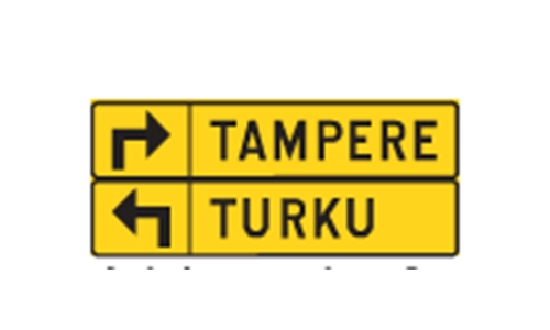
Yellow detour signs with destination names like AMPERE / TURKU indicate temporary alternative routes due to roadworks or disruptions, guiding drivers toward those cities.
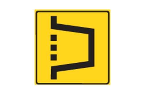
Yellow black detour arrow signs indicate a diversion route. These are used to redirect traffic around construction, closures, or obstacles while keeping vehicles moving in the intended direction.
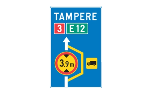
The sign lists 3.9 m, which refers to a height restriction. This informs drivers especially of tall vehicles about potential clearance issues on the detour, such as low bridges or tunnels.
Overhead lane signs with multiple arrows help drivers know which movements (e.g., straight, turn left/right) are allowed from each lane, improving traffic flow and safety.
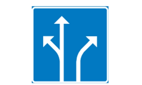
Blue overhead signs with downward arrows show which lanes are permitted to continue straight, aiding in lane discipline before junctions or merges.

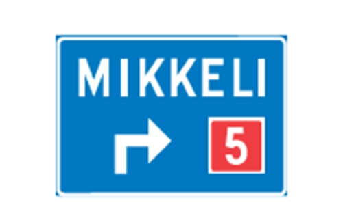
This overhead sign guides drivers toward the correct lane for exiting or continuing toward Mikkeli via route 5, helping avoid last minute lane changes.
his green overhead sign signals an approaching exit toward Kuopio, guiding drivers to move into the correct lane in time to leave the highway safely.

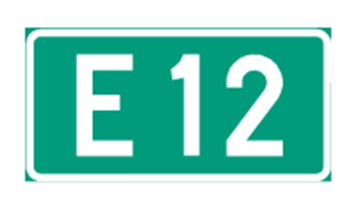
This overhead sign shows lane directions for long distance routes E7 and E16 toward Kotka, helping drivers select the correct lane for international or regional travel.

This directional sign indicates that road 119 leads toward Helsinki, giving essential routing information for motorists navigating toward the city.

This highway exit sign informs drivers that the next exit ramp connects to the road leading to Kuopio. It helps motorists prepare in advance for the correct lane or exit to reach their destination.

A direction sign with a white background usually indicates a private road in Finland. These roads may have restricted access, different traffic rules, or be maintained privately rather than by public authorities.

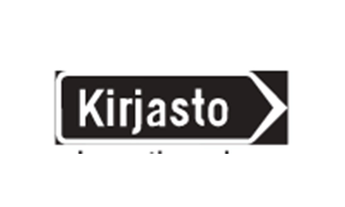
The Finnish word Kirjasto on a directional sign indicates the presence of a public library. These facilities are open to all and commonly offer books, internet access, and community services.
This blue directional sign is intended for pedestrians and cyclists, providing route guidance toward the area of Pihlajamäki. In Finland, such signs help non motorized traffic navigate safely through the road network.

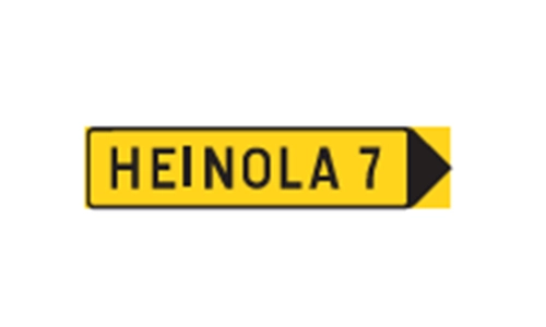
In Finland, a yellow road sign with destination and route info such as to Heinola indicates a temporary change like a detour. Drivers must follow this alternate route due to roadworks, closures, or other disruptions affecting the usual path.
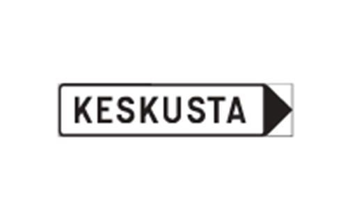
The word Keskusta on Finnish road signs indicates a route toward the heart of a city or town. This typically leads to areas with public buildings, major transit hubs, businesses, and other central services.
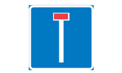
The T shaped No through road sign warns drivers that the road ends ahead. It is a dead end, so motorists must be ready to turn around or seek another route.
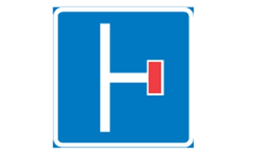
The L shaped no through road sign shows that a side road at an intersection ends in a dead end. It alerts drivers not to turn if theyre seeking a through route.
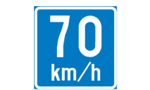
A round blue sign with a white 70 indicates a suggested speed. It is not legally binding but advises drivers on the optimal speed for safe driving based on road conditions, such as curves or reduced visibility.
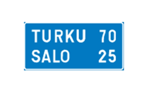
A rectangular sign showing TURKU 70 SALO 25 tells drivers how far they are from each listed city. These distance markers help with navigation, allowing travelers to estimate travel time and make route decisions.
A blue rectangular sign with a place name like PUNKA HARJU signifies you are entering a specific settlement. It serves an informational purpose and does not imply regulatory rules.

A brown road sign like Mallilan tie Tourist Road indicates a route recognized for its scenic, historical, or cultural interest. It is intended for leisure driving and tourism, not for high speed transit.

In Finland, a red square with a route number (like 2) designates a main national road, which serves as a key corridor for long distance traffic and freight, connecting major towns and regions across the country.
In Finland, a yellow square sign with a number like 42 denotes a secondary road, which links smaller towns or rural areas to larger national routes. These roads play a key role in regional connectivity and are part of the national road hierarchy.

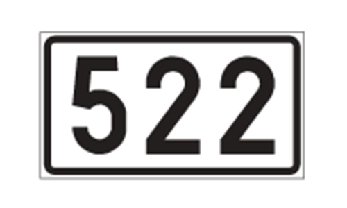
A white rectangular sign with a black number such as 522 indicates a regional road in Finland. These roads provide mid level connectivity, linking towns and villages across a region and bridging the gap between secondary and local roads.

A blue rectangular sign with a number like 3622 designates an ordinary road in Finland. These are the most basic category of public roads, typically serving local or rural traffic with standard access conditions.
A red square with the number 14 inside a dotted border indicates a directional route marker. It guides drivers toward a specific main road (here, Road 14) and is typically placed at intersections or ramps to aid navigation.

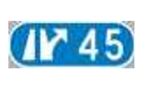
A blue sign with an arrow and a number like 45 identifies a specific motorway interchange. These numbers help drivers know which exit or junction they are approaching, aiding with navigation and route planning.

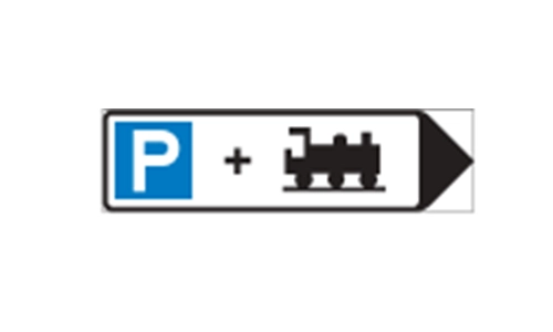
A blue sign with a ‘P , train icon, and arrow indicates a Park and Ride area. These allow drivers to park their vehicles and continue their journey by train, reducing city traffic and promoting public transport use.
A yellow rectangular sign with a diagonal black bar and arrow is used in roadwork or temporary traffic areas to instruct drivers to merge or change lanes. It ensures smooth traffic redirection and safety in altered driving conditions.
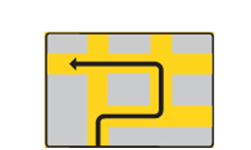
This yellow sign with a diagonal black bar and arrow indicates a temporary shift in lane alignment, commonly used in construction or detour zones. It guides drivers to change lanes smoothly to avoid obstacles or closures.

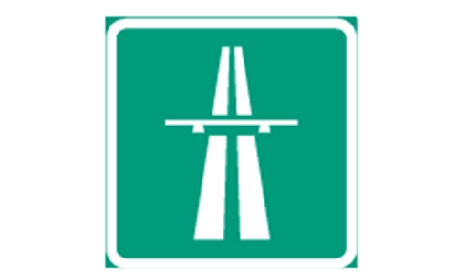
This green sign featuring a bridge like symbol represents a motorway (moottoritie in Finnish). It designates a high speed, limited access road designed for uninterrupted long distance travel, with on ramps, off ramps, and no direct intersections.
This green sign with a white car symbol designates a road reserved exclusively for motor vehicles. It prohibits access to pedestrians, cyclists, and mopeds, ensuring safer and more efficient traffic flow on higher speed routes.

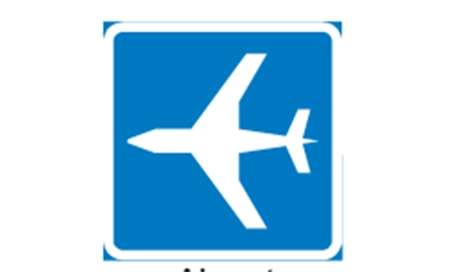
A blue sign featuring an airplane symbol directs drivers to a nearby airport offering passenger air services. It is used on major routes to guide travelers toward air travel facilities efficiently.
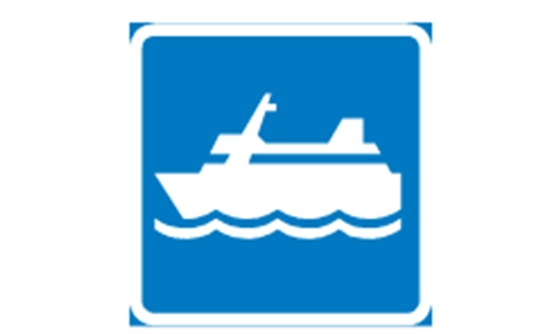
A blue sign with a ship symbol indicates the presence of a ferry terminal. It guides drivers to a facility where vehicles and passengers can board ferries to cross water bodies, commonly used in Finland s extensive lake and coastal regions.
A blue sign featuring a ship and crane indicates a commercial harbor used for freight operations. It marks areas designated for loading and unloading goods from cargo ships, essential for logistics and trade routes.

A blue sign with a factory silhouette represents an area zoned for industrial purposes such as manufacturing, warehousing, and commercial logistics. It helps guide drivers seeking business or freight related destinations.

The blue sign marked with a white ’P’ designates a location where motorists are allowed to park their vehicles legally. It is a universal parking symbol used throughout Finland and other countries.

A blue sign with a train icon directs road users toward a public railway station where passengers can board or exit trains. It is not intended for freight or maintenance access.